No products in the cart.: $0.00

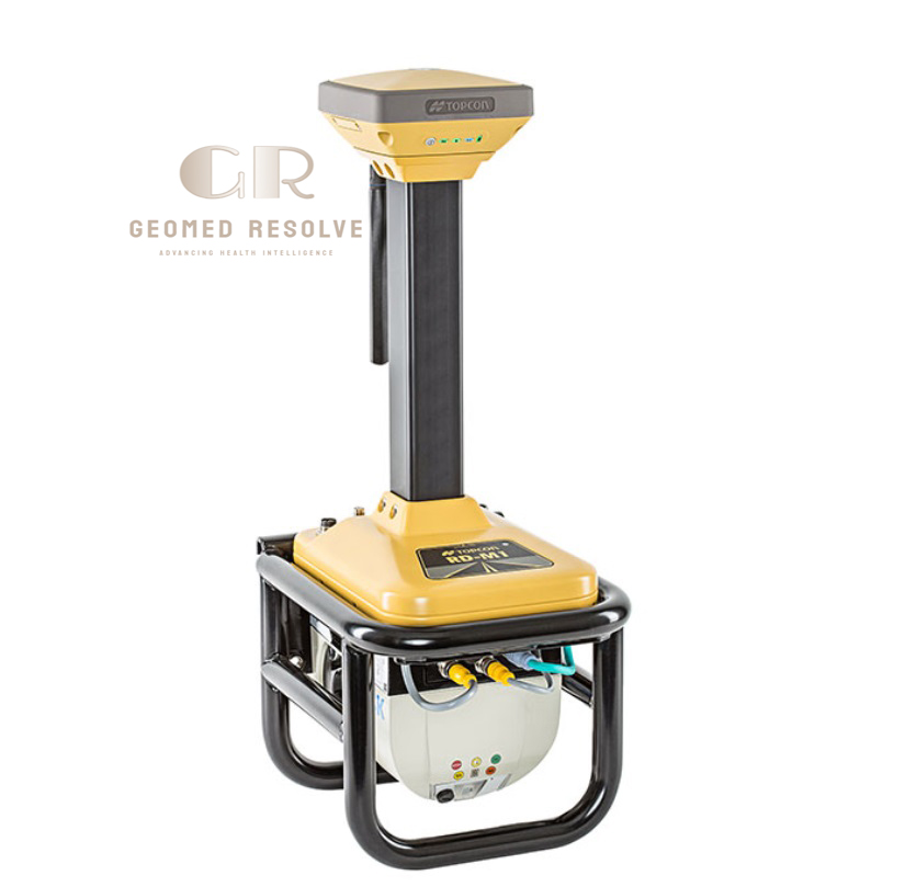
Topcon RD-M1 Scanner
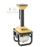
The Topcon RD-M1 Scanner is a professional LiDAR & Laser Scanning Equipment solution designed for rapid road surface mapping, pavement assessment, highway resurfacing, and infrastructure surveying. Mounted on a survey vehicle, the RD-M1 captures millions of high-density LiDAR points while driving at normal traffic speeds, eliminating the need for lane closures. Integrated with a HiPer SR/VR GNSS receiver, Inertial Measurement Unit (IMU), and MAGNET Office Site with Resurfacing software, the scanner produces highly accurate point clouds for road rehabilitation, milling, paving, and SmoothRide workflows.
Description
Topcon RD-M1 Scanner – Vehicle-Mounted Road Resurfacing LiDAR Scanner
The Topcon RD-M1 Scanner is an advanced LiDAR & Laser Scanning Equipment solution engineered for rapid, high-accuracy road surface mapping and pavement assessment. Designed as a vehicle-mounted LiDAR system, it captures millions of georeferenced points while traveling at normal driving speeds, eliminating the need for lane closures and significantly improving survey efficiency. Integrated with HiPer GNSS positioning, an Inertial Measurement Unit (IMU), and Topcon’s digital resurfacing workflow, the RD-M1 provides highly accurate point clouds for road rehabilitation, milling, paving, and infrastructure management.
With scan rates of up to 100 scans per second, IP66 environmental protection, and seamless compatibility with MAGNET Office Site with Resurfacing and SmoothRide software, the RD-M1 enables engineers and contractors to create precise digital road models for efficient project planning and automated machine control. Its rugged construction, simple installation, and advanced positioning capabilities make it an ideal solution for highway surveying, pavement rehabilitation, and transportation infrastructure projects.
The Topcon RD-M1 Scanner is an excellent choice for highway contractors, civil engineers, transportation authorities, road maintenance agencies, and professional surveying companies seeking a reliable mobile LiDAR solution for road resurfacing and infrastructure mapping.
Main Benefits
Scan at Normal Driving Speeds
Collects road surface data without interrupting traffic, reducing project time and improving crew safety.
High-Density LiDAR Data
Captures millions of points to generate detailed pavement models for resurfacing design.
No Lane Closures Required
Enables efficient highway surveys while traffic continues normally, minimizing operational disruption.
Accurate Road Surface Modeling
Provides highly accurate elevation data for milling depth calculations and asphalt quantity estimation.
Integrated Positioning
Works seamlessly with GNSS and IMU technology for precise georeferenced point cloud generation.
Optimized for SmoothRide
Designed to integrate with Topcon SmoothRide solutions for automated paving and milling operations.
Key Features
Downward-Facing LiDAR Scanner
Optimized specifically for accurate road surface scanning and pavement profiling.
High-Speed Scanning
Up to 100 scans per second
Millions of points collected during normal vehicle travel.
Integrated GNSS & IMU
Supports:
HiPer SR or HiPer VR GNSS Receiver
Inertial Measurement Unit (IMU)
for accurate positioning while driving.
Automatic Point Cloud Generation
Data is automatically time-stamped and stored for efficient point cloud creation and processing.
Easy Vehicle Installation
Quick installation and removal make the system suitable for daily surveying operations.
Intuitive Data Collection Software
Graphical software simplifies field operation and post-processing workflows.
Road Resurfacing Workflow
Compatible with:
MAGNET Office Site with Resurfacing
SmoothRide™ Digital Paving Workflow
for road rehabilitation projects.
Rugged Industrial Construction
Designed for continuous outdoor operation on construction and surveying vehicles.
Specifications
Product Type: Vehicle-Mounted Mobile LiDAR Road Scanner
Category: LiDAR & Laser Scanning Equipment
Subcategory: Mobile LiDAR Road Scanners
Manufacturer: Topcon Positioning Systems
Model: RD-M1
Scanning Technology
Vehicle-Mounted LiDAR Scanner
Scan Rate
Up to 100 scans per second
Intensity Levels
255
Power Supply
9–32 VDC
Operating Current
3 A
Peak Current
7.5 A
Kinematic Elevation Accuracy
<10 mm (1 Sigma) on curved road sections
<5 mm (2 Sigma) on straight road sections
Positioning System
Integrated HiPer SR/HiPer VR GNSS Receiver
Inertial Measurement Unit (IMU)
Housing
Powder-Coated Cast Aluminum
Protection Rating
IP66
Weight
Approximately 12.5 kg
Software Compatibility
MAGNET Office Site with Resurfacing
SmoothRide Workflow
Topcon Office
Applications
Road Surface Mapping
Highway Resurfacing
Pavement Profiling
Asphalt Thickness Planning
Milling Design
Road Condition Assessment
Recommended Industries
Highway Construction
Road Maintenance
Civil Engineering
Surveying
Transportation Infrastructure
Government Road Agencies
Applications
Road Resurfacing
Captures existing pavement conditions for asphalt overlay and rehabilitation planning.
Pavement Condition Survey
Produces accurate digital road surface models for engineering analysis.
Milling Operations
Supports variable-depth milling design and automated milling workflows.
Asphalt Paving
Provides detailed surface data for smooth and efficient paving operations.
Infrastructure Surveying
Maps highways, roads, and transportation corridors with high-density LiDAR data.
Civil Engineering
Assists engineers with road design, construction planning, and quality control.
Transportation Asset Management
Creates accurate digital records of roadway conditions for maintenance planning.
What is the Topcon RD-M1 Scanner?
The Topcon RD-M1 is a vehicle-mounted LiDAR scanner developed for road resurfacing, pavement surveying, and highway infrastructure mapping.
How fast can the RD-M1 scan?
The scanner captures data at up to 100 scans per second while traveling at normal road speeds.
Does the RD-M1 require road closures?
No. It is specifically designed to collect accurate road surface data while normal traffic continues.
Which positioning technologies are integrated?
The system integrates a HiPer SR or HiPer VR GNSS receiver together with an IMU for accurate georeferenced point cloud collection.
Which software is compatible with the RD-M1?
The scanner works with MAGNET Office Site with Resurfacing, SmoothRide, and Topcon Office software for pavement modeling and project design.
Who commonly uses the Topcon RD-M1?
It is widely used by highway contractors, road construction companies, civil engineers, transportation agencies, pavement consultants, and professional surveying firms.