No products in the cart.: $0.00

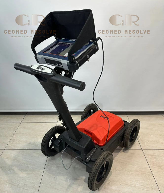
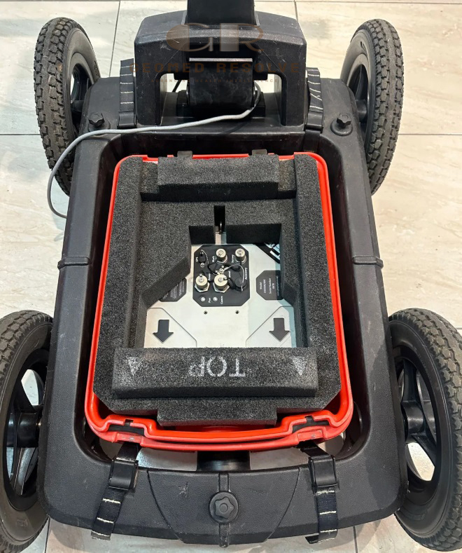
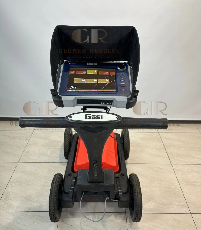
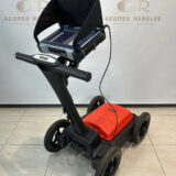
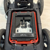
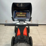
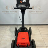
GSSI UtilityScan Pro SIR 4000 with 300/800 DF Antenna
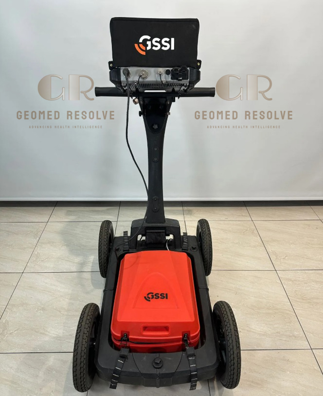
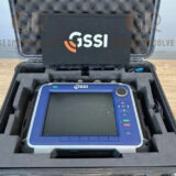
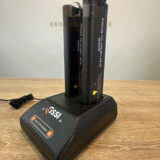
The GSSI UtilityScan Pro SIR 4000 with 300/800 DF Antenna is a professional Surveying Equipment solution designed for underground utility locating, subsurface mapping, and geophysical investigations. Powered by the advanced SIR 4000 controller and equipped with the 300/800 MHz Dual-Frequency (DF) antenna, the system delivers exceptional detection of both shallow and deeper underground targets in a single survey. It accurately locates metallic and non-metallic utilities, including PVC pipes, electrical cables, gas lines, sewer systems, and underground storage tanks. The rugged, portable design and advanced RADAN® data processing make it an ideal solution for utility mapping, civil engineering, construction, archaeology, environmental assessment, and road inspection
📦 Secure checkout
📦 Secure checkout
✅️SATISFACTION GUARANTEED
✅️FREE SHIPPING ON ORDER OVER $100
✅️SECURE PAYMENTS
✅️MONEY BACK 30 DAYS GUARANTEE
✅️EASY RETURNS

✈️ FAST AND FREE DELIVERY
✈️ FAST AND FREE DELIVERY
🎧 24/7 CUSTOMER SUPPORT
🎧 24/7 CUSTOMER SUPPORT
Description
GSSI UtilityScan Pro SIR 4000 with 300/800 DF Antenna – Ground Penetrating Radar System for Utility Detection
The GSSI UtilityScan Pro SIR 4000 with 300/800 DF Antenna is a high-performance Surveying Equipment solution developed for professional underground utility detection and subsurface imaging. Combining the advanced SIR 4000 controller with the 300/800 MHz Dual-Frequency antenna, the system provides outstanding versatility by delivering both deep penetration and high-resolution imaging in a single survey. This enables accurate detection of metallic and non-metallic underground utilities while improving productivity and reducing field time.
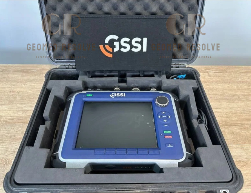
Featuring a rugged IP65-rated controller, 10.4-inch sunlight-readable display, internal GPS logging, scan rates up to 4,000 scans per second, and compatibility with RADAN® processing software, the UtilityScan Pro offers exceptional performance for utility mapping, infrastructure inspections, road surveys, archaeology, and environmental investigations. Its modular platform also supports additional GSSI antennas for expanded applications, making it a versatile solution for modern surveying professionals.
The GSSI UtilityScan Pro SIR 4000 with 300/800 DF Antenna is an excellent solution for land surveyors, civil engineers, utility locating companies, infrastructure contractors, municipalities, and environmental consultants seeking a reliable, high-performance ground penetrating radar system for accurate underground utility detection and mapping.
Main Benefits
Dual-Frequency Ground Penetrating Radar
The 300 MHz and 800 MHz antenna combination provides excellent depth penetration and high-resolution imaging in one system.
Accurate Utility Detection
Locates metallic and non-metallic underground utilities with high confidence before excavation.
Increased Survey Efficiency
Simultaneously detects shallow and deeper buried objects, reducing the need for multiple surveys.
Advanced SIR 4000 Controller
Offers real-time data visualization, filtering, and high-speed data acquisition for improved productivity.
Rugged Field Performance
IP65-rated controller withstands harsh outdoor environments and demanding construction sites.
Versatile Survey Applications
Suitable for utility locating, infrastructure assessment, archaeology, environmental studies, and transportation projects.
Key Features
SIR 4000 Ground Penetrating Radar Controller
Professional GPR controller with advanced imaging and field processing capabilities.
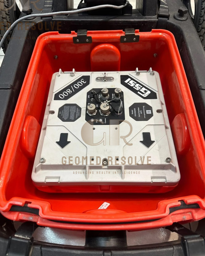
300/800 MHz Dual-Frequency Antenna
Combines:
300 MHz for greater penetration depth
800 MHz for high-resolution shallow imaging
allowing detection of utilities at multiple depths during a single scan.
High-Speed Data Collection
Supports scan rates up to 4,000 scans per second for rapid field surveys.
Large Color Display
10.4-inch sunlight-readable color display with 1024 × 768 resolution.
Internal GPS Support
Stores positioning information for accurate utility mapping.
Multiple Display Modes
Supports:
LineScan
O-Scope
Wiggle Trace
Full 3D Imaging
for comprehensive data interpretation.
RADAN Compatibility
Compatible with RADAN® software for advanced processing, interpretation, and reporting.
Expandable Antenna Platform
Compatible with additional GSSI antennas for concrete inspection, bridge evaluation, and other GPR applications.
Specifications
Product Type: Ground Penetrating Radar System
Category: Surveying Equipment
Subcategory: Ground Penetrating Radar (GPR) Systems
Manufacturer: GSSI
Model: UtilityScan Pro SIR 4000
Controller
SIR 4000
Antenna
300/800 MHz Dual-Frequency Antenna
Scanning Technology
Ground Penetrating Radar (GPR)
Maximum Investigation Depth
Up to approximately 7 m (application dependent)
Display
10.4-inch LED Color Display
1024 × 768 Resolution
Storage
32 GB Flash Memory
1 GB RAM
GPS
Internal GPS Data Logging
Scan Rate
Up to 4,000 Scans per Second
Protection Rating
IP65
Data Format
RADAN (.dzt)
Operating Modes
Continuous Scan
Distance Trigger
Point Mode
Applications
Underground Utility Detection
Utility Mapping
Infrastructure Survey
Road Inspection
Archaeology
Environmental Investigation
Recommended Industries
Surveying
Civil Engineering
Construction
Utility Mapping
Transportation
Environmental Consulting
Archaeology
Applications
Underground Utility Detection
Locates buried electrical cables, gas pipelines, water pipes, fiber optic cables, and sewer lines.
Utility Mapping
Creates accurate subsurface maps before excavation and construction.
Civil Engineering
Supports planning and infrastructure development with reliable underground imaging.
Road & Highway Inspection
Evaluates pavement conditions and detects buried infrastructure.
Environmental Investigation
Identifies underground features during site assessments and remediation projects.
Archaeological Survey
Locates buried structures and artifacts without excavation.
Damage Prevention
Helps prevent accidental utility strikes during construction activities.
What is the GSSI UtilityScan Pro SIR 4000?
It is a professional ground penetrating radar system designed for underground utility locating, mapping, and subsurface investigations.
What is the advantage of the 300/800 DF antenna?
The dual-frequency antenna combines deeper penetration from the 300 MHz channel with higher-resolution imaging from the 800 MHz channel, enabling detection of utilities at multiple depths in a single survey.
What utilities can the system detect?
It can locate metallic and non-metallic utilities including PVC pipes, electrical cables, telecommunications conduits, gas lines, water pipes, sewer lines, and underground storage tanks.
Which software is compatible with the UtilityScan Pro?
The system is compatible with RADAN® software for advanced data processing, interpretation, and reporting.
Is the UtilityScan Pro suitable for outdoor field work?
Yes. The SIR 4000 controller features an IP65-rated rugged design suitable for demanding construction and surveying environments.
Who commonly uses the UtilityScan Pro?
It is widely used by surveyors, utility locating contractors, civil engineers, municipalities, construction companies, environmental consultants, and archaeological professionals.