No products in the cart.: $0.00

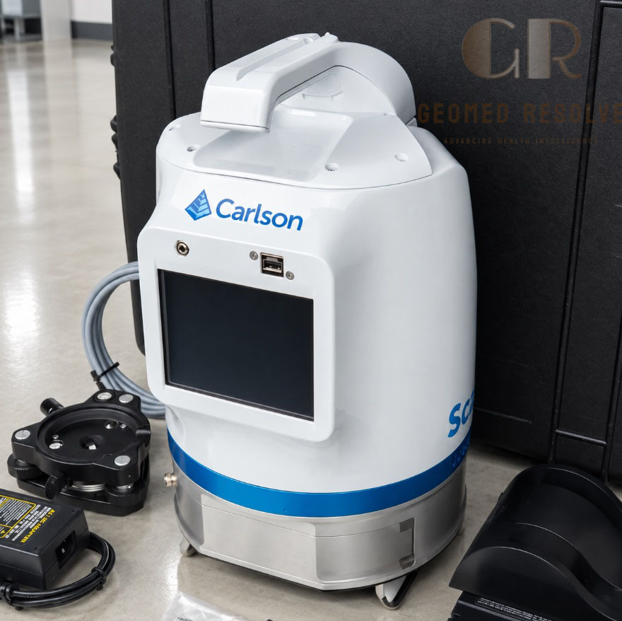
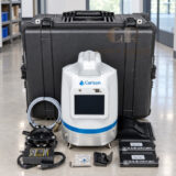
Carlson Scan2k Terrestrial 3D Laser Scanner
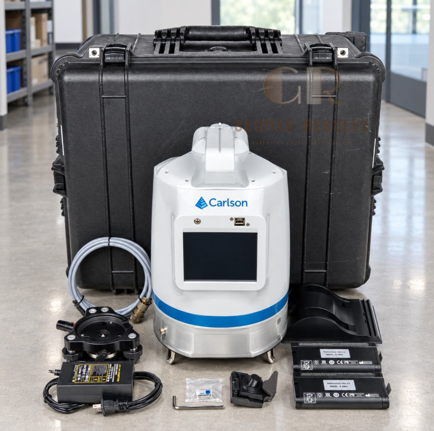
The Carlson Scan2K Terrestrial 3D Laser Scanner is a long-range LiDAR surveying system designed to capture detailed point clouds for mining, construction, infrastructure, topographic surveying, and industrial mapping. With scanning distances up to 2,000 meters, integrated GNSS and imaging sensors, four-return recording, and flexible tripod or mobile deployment, it supports efficient large-scale 3D reality capture.
Description
Carlson Scan2k Terrestrial 3D Laser Scanner – Professional LiDAR Reality-Capture and Point-Cloud Surveying System
The Carlson Scan2K Terrestrial 3D Laser Scanner is a professional long-range LiDAR system designed for surveying, mining, construction, infrastructure documentation, and large-scale reality-capture projects. Its pulsed time-of-flight technology supports scanning distances of up to 2,000 meters under suitable target and atmospheric conditions.
The Scan2K combines high-speed point collection with an integrated camera, L1 GNSS receiver, digital compass, inclinometers, onboard touchscreen, and weather-resistant housing. It can be deployed on a tripod, vehicle, or other mobile platform, making it suitable for both stationary terrestrial scanning and mobile mapping workflows.
Main Benefits
Captures detailed 3D point-cloud data over short, medium, and long ranges.
Supports scanning distances of up to 2,000 meters under suitable conditions.
Helps reduce field time during large-area surveys.
Supports mine, quarry, stockpile, and high-wall mapping.
Integrated GNSS, compass, and inclinometers support rapid georeferencing.
Records up to four returns from each laser pulse.
Can be deployed on a tripod, vehicle, or mobile platform.
Supports point-cloud registration, terrain modeling, and feature extraction.
Integrated imaging improves visual documentation and point-cloud interpretation.
Key Features
Pulsed time-of-flight LiDAR scanning.
Short-, medium-, and long-range scanning modes.
Maximum range of up to 2,000 m at 90% reflectivity.
Data collection rates of up to 500,000 points per second.
Up to four returns recorded per laser pulse.
360° horizontal field of view.
Up to 120° vertical field of view.
Integrated high-resolution panoramic camera system.
Onboard L1 GPS and GLONASS receiver.
Digital compass and dual-axis inclinometer.
Sunlight-visible color touchscreen.
250 GB internal SSD.
Hot-swappable lithium-ion batteries.
Wireless LAN, USB, and Ethernet connectivity.
Automatic georeferencing and target-free alignment support.
Compatible with ATLAScan and Carlson Point Cloud Advanced workflows.
Key Specifications
Product: Carlson Scan2K Terrestrial 3D Laser Scanner
Scanner type: Terrestrial LiDAR scanner
Measurement principle: Pulsed time-of-flight
Laser wavelength: 1550 nm
Maximum range at 90% reflectivity: 2,000 m
Maximum range at 20% reflectivity: 976 m
Short-range capability: 250 m at 90% reflectivity
Medium-range capability: 750 m at 90% reflectivity
Laser repetition rate: 50 kHz, 200 kHz, and 500 kHz
Maximum sample collection rate: Up to 2 MHz
Maximum recorded returns: Up to four per pulse
Intensity recording: 12-bit
Minimum range: 1.5 m
Range accuracy: 5 mm at 100 m, one sigma
Range resolution: 2 mm
Single-shot precision: 4 mm at 100 m, one sigma
Angular accuracy: 80 µrad
Angular measurement resolution: Up to 12 µrad
Horizontal field of view: 360°
Vertical field of view: Up to 120°
Maximum point spacing: Approximately 2 mm at 100 m
Inclinometer accuracy: Up to 0.01°
GNSS: L1 GPS and GLONASS
Compass: Integrated digital compass
Internal storage: 250 GB SSD
Display: Sunlight-visible color touchscreen
Display resolution: 640 × 480 pixels
Battery: Hot-swappable lithium-ion batteries
Typical battery operating time: Approximately 2.5 hours
Power consumption: Approximately 60 W
Operating temperature: −20°C to +50°C
Height: Approximately 323 mm
Width: Approximately 217 mm
Weight: Approximately 11.2 kg
Deployment options: Tripod, vehicle, or mobile platform
Connectivity: Wireless LAN, USB, and Ethernet
Software workflow: ATLAScan and Carlson Point Cloud Advanced.
Applications
Land surveying and topographic mapping.
Mine and quarry surveying.
Stockpile volume calculations.
High-wall scanning and monitoring.
Tunnel and underground mine mapping.
Convergence analysis.
Construction site documentation.
Infrastructure and transportation surveys.
Industrial facility mapping.
Terrain modeling and digital elevation models.
Corridor and right-of-way mapping.
3D point-cloud generation.
Vegetation and terrain analysis.
Mobile mapping and large-area reality capture.
Typical Users
Land surveyors.
Mining companies.
Quarry operators.
Civil engineers.
Construction contractors.
Geospatial mapping specialists.
Infrastructure inspection teams.
Geotechnical engineers.
Surveying and engineering consultants.
GIS professionals.
Industrial measurement teams.
Reality-capture service providers.
What is the Carlson Scan2K used for?
The Carlson Scan2K is used for terrestrial LiDAR surveying, mine mapping, stockpile measurement, high-wall monitoring, topographic surveys, construction documentation, and 3D point-cloud generation.
What is the maximum scanning range?
The Scan2K can reach up to 2,000 meters at 90% reflectivity under suitable atmospheric and target conditions. Actual range depends on surface reflectivity, visibility, scan settings, and environmental conditions.
Can the Scan2K record multiple returns?
Yes. The scanner can record up to four returns from each laser pulse, helping capture objects such as vegetation in front of structures and surfaces located behind them.
Can the scanner be used on a tripod?
Yes. The Scan2K can be configured for tripod-based terrestrial scanning. It can also be deployed on a vehicle or other mobile platform.
Does the Scan2K include GNSS?
Yes. The system includes an onboard L1 GPS and GLONASS receiver, as well as a digital compass and dual-axis inclinometer for positioning and orientation support.
What software is compatible with the Carlson Scan2K?
The Scan2K is designed to work with ATLAScan for point-cloud registration and Carlson Point Cloud Advanced for feature extraction and related CAD workflows.