No products in the cart.: $0.00

Maptek SR3 Laser Scanner
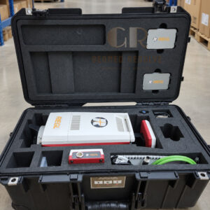
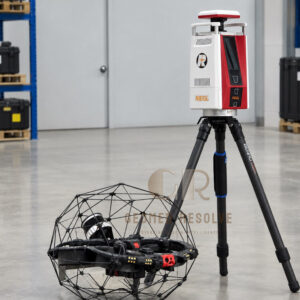
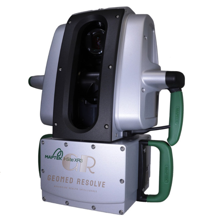
The Maptek SR3 Laser Scanner is a professional LiDAR & Laser Scanning Equipment solution designed for high-resolution 3D surveying, mining, quarry mapping, geotechnical monitoring, civil engineering, and infrastructure documentation. Utilizing advanced Time-of-Flight (ToF) laser technology, the SR3 delivers precise long-range measurements with an accuracy of 4 mm, a scanning range of up to 600 meters, and data acquisition speeds of up to 400,000 points per second. Featuring an integrated panoramic camera, IP65 protection, built-in GNSS, and rugged field construction, the SR3 is ideal for demanding outdoor surveying and reality capture applications.
📦 Secure checkout
📦 Secure checkout
✅️SATISFACTION GUARANTEED
✅️FREE SHIPPING ON ORDER OVER $100
✅️SECURE PAYMENTS
✅️MONEY BACK 30 DAYS GUARANTEE
✅️EASY RETURNS

✈️ FAST AND FREE DELIVERY
✈️ FAST AND FREE DELIVERY
🎧 24/7 CUSTOMER SUPPORT
🎧 24/7 CUSTOMER SUPPORT
Description
Maptek SR3 Laser Scanner – High-Resolution Terrestrial 3D Laser Scanner for Mining and Surveying
The Maptek SR3 Laser Scanner is an advanced LiDAR & Laser Scanning Equipment solution developed for professional 3D surveying, mining operations, quarry management, civil engineering, and infrastructure documentation. Powered by Time-of-Flight laser technology, the scanner delivers highly accurate 3D measurements with 4 mm accuracy, reflectorless scanning up to 600 meters, and acquisition speeds reaching 400,000 points per second. Its integrated GNSS receiver, panoramic imaging capability, and rugged IP65-rated design enable reliable performance in demanding outdoor environments.
Designed for productivity in the field, the SR3 offers a 360° horizontal and 130° vertical field of view, integrated laser aimer, wireless tablet operation, and compatibility with Maptek PointStudio software for advanced point cloud processing and visualization. Whether used for stockpile measurements, slope stability monitoring, topographic mapping, or industrial asset documentation, the scanner provides precise, efficient, and dependable reality capture for large-scale projects.
The Maptek SR3 Laser Scanner is an excellent solution for mining professionals, surveyors, civil engineers, construction companies, and infrastructure specialists seeking a rugged, high-performance terrestrial laser scanner for accurate 3D reality capture.
Main Benefits
High-Precision 3D Scanning
Delivers 4 mm measurement accuracy for accurate point clouds and reliable survey results.
Long-Range Performance
Scans targets up to 600 meters without reflectors, making it suitable for mines, quarries, and large infrastructure projects.
High-Speed Data Collection
Captures up to 400,000 points per second, reducing field time while maintaining excellent point density.
Integrated GNSS
Built-in GPS/QZSS receiver simplifies scanner positioning and georeferencing.
Rugged Outdoor Design
IP65-rated enclosure ensures reliable operation in dusty, wet, and harsh industrial environments.
Professional Mining Workflow
Optimized for mining, quarry surveying, geotechnical monitoring, and civil engineering projects using Maptek software solutions.
Key Features
Time-of-Flight Laser Technology
Professional pulsed Time-of-Flight laser provides accurate long-distance measurements.
High Scan Speed
Supports acquisition rates of:
100 kHz
200 kHz
400 kHz
for efficient large-area scanning.
Long Measurement Range
Maximum Range: 600 m
Minimum Range: 1 m
Wide Field of View
Horizontal: 360°
Vertical: 130° (-40° to +90°) for comprehensive site coverage.
Integrated Laser Aimer
Built-in 635 nm Class 1 red laser aimer assists with accurate target positioning.
Built-In GNSS Receiver
Supports integrated L1 GPS and QZSS positioning for efficient field setup.
Rugged Tablet Operation
Operates with the rugged FieldHHC Panasonic Toughbook controller for dependable field performance.
Industrial Construction
Designed for continuous operation in mining, civil engineering, and heavy industrial environments.
Specifications
Product Type: Terrestrial 3D Laser Scanner
Category: LiDAR & Laser Scanning Equipment
Subcategory: Terrestrial 3D Laser Scanners
Manufacturer: Maptek
Model: SR3
Scanning Technology
Time-of-Flight (ToF)
Laser Class
Class 1 (IEC 60825-1:2014)
Laser Wavelength
Near Infrared
Laser Aimer
635 nm Red Laser
Maximum Range
600 m (Reflectorless)
Minimum Range
1 m
Measurement Accuracy
4 mm
Repeatability
±4 mm
Scan Speed
Up to 400,000 points per second
Field of View
Horizontal: 360°
Vertical: 130°
Angular Resolution
0.2° to 0.025°
Integrated Positioning
L1 GPS
QZSS
Protection Rating
IP65
Battery Runtime
Approximately 2 Hours
Operating Temperature
0°C to +50°C
Weight
Approximately 10.1 kg
Connectivity
Wi-Fi
Ethernet
USB
Applications
Mining Survey
Quarry Survey
Stockpile Measurement
Civil Engineering
Infrastructure Documentation
Geotechnical Monitoring
Topographic Survey
Recommended Industries
Mining
Surveying
Civil Engineering
Construction
Infrastructure
Geology
Quarry Operations
Applications
Mining Surveying
Captures accurate 3D mine surfaces, benches, and underground excavations.
Quarry Mapping
Measures stockpiles, pit walls, and quarry production volumes.
Topographic Survey
Produces detailed terrain models for engineering and land development.
Infrastructure Documentation
Captures bridges, tunnels, roads, and industrial facilities in high-resolution 3D.
Geotechnical Monitoring
Supports slope stability analysis and deformation monitoring.
Construction Projects
Provides accurate point clouds for planning, verification, and progress monitoring.
Industrial Asset Documentation
Creates digital models for maintenance, inspection, and asset management.
What is the Maptek SR3 Laser Scanner?
The Maptek SR3 is a professional terrestrial 3D laser scanner developed for mining, surveying, civil engineering, and infrastructure documentation.
What is the maximum scanning range?
The SR3 provides reflectorless scanning up to 600 meters, depending on target reflectivity and environmental conditions.
How accurate is the Maptek SR3?
The scanner delivers 4 mm measurement accuracy with ±4 mm repeatability.
How fast can the SR3 scan?
The scanner captures data at speeds up to 400,000 points per second.
Does the scanner include GPS?
Yes. The SR3 features an integrated L1 GPS and QZSS GNSS receiver for positioning and georeferencing.
Who commonly uses the Maptek SR3?
It is widely used by mining companies, surveyors, civil engineers, geotechnical consultants, construction contractors, and infrastructure professionals.