
No products in the cart.: $0.00


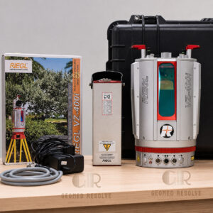
TOPCON GLS-2000 3D laser scanner
High-precision 3D laser scanning technology for accurate surveying, construction, and digital reality capture workflows
Description
TOPCON GLS-2000 3D Laser Scanner – High-Accuracy LiDAR Surveying and Reality Capture System
The TOPCON GLS-2000 3D laser scanner is a professional terrestrial LiDAR scanning system designed for high-accuracy surveying, construction documentation, engineering measurement, and reality capture applications. With advanced scanning technology, fast data acquisition, and high-resolution imaging, the GLS-2000 helps professionals create precise 3D models and detailed point cloud data for complex projects.
Key Features
High-Accuracy 3D Laser Scanning
Captures precise three-dimensional measurements for professional surveying and engineering applications.
Fast Point Cloud Data Collection
Efficiently collects dense point cloud data to reduce field time and improve productivity.
Long-Range LiDAR Performance
Designed for scanning large environments, structures, and outdoor areas with reliable measurement accuracy.
High-Resolution Digital Imaging
Integrated camera system provides detailed color information for realistic 3D documentation.
Multiple Scanning Modes
Supports different scan settings to optimize speed, range, and data quality based on project requirements.
Advanced Surveying Workflow
Designed to integrate with professional surveying, CAD, and BIM software platforms.
Rugged Field Design
Built for professional use in construction sites, surveying environments, and industrial locations.
Easy Operation
User-friendly interface helps operators quickly configure and complete scanning tasks.
Specifications
Product Type: Terrestrial 3D laser scanner
Manufacturer: Topcon Positioning Systems
Model: GLS-2000
Technology: LiDAR (Light Detection and Ranging)
Scanner Type: Ground-based laser scanner
Measurement Output:
3D point clouds
Digital terrain data
3D models
Applications:
Surveying
Construction documentation
BIM projects
Industrial measurement
Infrastructure inspection
Data Compatibility:
CAD workflows
BIM workflows
Point cloud processing software
Imaging:
Integrated digital photography support
Operation:
Field-based scanning system
Applications
Construction Surveying
Creates accurate 3D site documentation for planning, progress monitoring, and verification.
Building Information Modeling (BIM)
Provides precise point cloud data for creating and updating digital building models.
Topographic Surveying
Supports land measurement, mapping, and terrain analysis projects.
Industrial Facility Documentation
Captures complex structures, equipment layouts, and production environments.
Infrastructure Inspection
Helps document bridges, roads, tunnels, and large engineering structures.
Architecture and Heritage Documentation
Supports accurate recording of buildings, historical sites, and complex structures.
Why Choose TOPCON GLS-2000?
The TOPCON GLS-2000 3D laser scanner combines precision, speed, and reliability for professional reality capture projects. Its advanced LiDAR technology allows surveyors, engineers, and construction professionals to collect accurate spatial data and improve project workflows.
With strong measurement performance, flexible scanning options, and compatibility with modern digital workflows, GLS-2000 is a valuable solution for demanding surveying and engineering applications.
What is the TOPCON GLS-2000 used for?
The TOPCON GLS-2000 is used for professional 3D laser scanning, surveying, construction documentation, BIM modeling, and industrial measurement.
What technology does the GLS-2000 use?
The GLS-2000 uses LiDAR technology to capture accurate three-dimensional measurements and generate detailed point cloud data.
Who uses the TOPCON GLS-2000 laser scanner?
It is commonly used by surveyors, civil engineers, architects, construction professionals, and industrial measurement specialists.
Can TOPCON GLS-2000 create 3D models?
Yes. The scanner captures point cloud data that can be processed into detailed 3D models and digital representations.
Is the TOPCON GLS-2000 suitable for construction projects?
Yes. It is designed for construction surveying, as-built documentation, BIM workflows, and site measurement.
What are the advantages of 3D laser scanning?
3D laser scanning provides faster data collection, improved measurement accuracy, and detailed digital documentation compared with traditional measurement methods.
Can GLS-2000 be used outdoors?
Yes. The system is designed for professional outdoor and indoor scanning applications, including construction sites and infrastructure projects.
What software can process GLS-2000 data?
GLS-2000 data can be processed using compatible point cloud, CAD, and BIM software solutions.

There are no reviews yet.