
No products in the cart.: $0.00
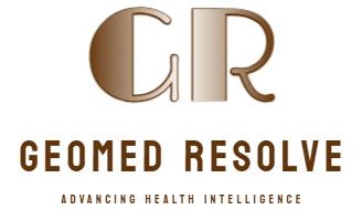


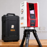
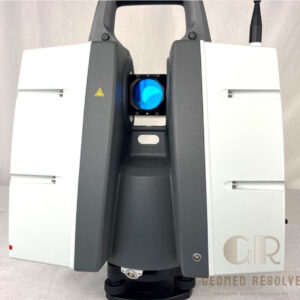
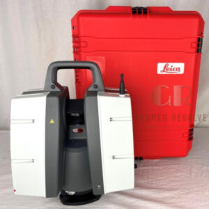
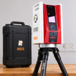
RIEGL VZ-600i Terrestrial 3D Laser Scanner
Capture accurate 3D spatial data faster with automated workflows, real-time registration, and advanced LiDAR technology that significantly reduces field and office processing time
Description
RIEGL VZ-600i Terrestrial 3D Laser Scanner
The RIEGL VZ-600i Terrestrial 3D Laser Scanner is a next-generation mobile and static laser scanning solution designed for fast, accurate, and efficient reality capture. Featuring automatic scan registration, real-time data processing, and advanced LiDAR technology, the VZ-600i enables surveyors, engineers, and geospatial professionals to collect high-density 3D point cloud data with exceptional speed and precision.
Key Features
High-speed terrestrial 3D laser scanning technology.
Automatic scan registration in the field.
Real-time point cloud visualization and processing.
Advanced RIEGL Waveform-LiDAR technology.
Mobile and static scanning capabilities.
Lightweight and highly portable design.
Integrated camera system for colorized point clouds.
Wireless tablet control and operation.
Efficient data acquisition for large projects.
Seamless integration with surveying, BIM, GIS, and engineering software.
Specifications
Model: RIEGL VZ-600i
Scanner Type: Terrestrial 3D Laser Scanner
Laser Technology: RIEGL Waveform-LiDAR
Maximum Measurement Range: Up to 1,000 m
Data Capture: High-density 3D point clouds
Real-Time Registration: Yes
Integrated Imaging System: Yes
Connectivity: Wi-Fi, Ethernet, USB
Positioning Support: GNSS and georeferencing compatibility
Operation Mode: Static and mobile scanning
Environmental Design: Rugged field-ready construction
Application Environment: Indoor and outdoor use
Applications
Topographic and land surveying
Building Information Modeling (BIM)
Construction progress monitoring
Infrastructure and transportation projects
Mining and quarry surveying
Utility and corridor mapping
Industrial plant documentation
Architecture and heritage preservation
Digital twin creation
Reality capture and geospatial data collection
Why Choose the RIEGL VZ-600i?
The RIEGL VZ-600i combines speed, portability, and accuracy in a single advanced laser scanning platform. Its automated registration workflow and real-time data processing capabilities help professionals complete projects faster while maintaining exceptional data quality. This makes it an ideal solution for surveying, engineering, construction, and infrastructure applications where efficiency and precision are critical.
There are no reviews yet.